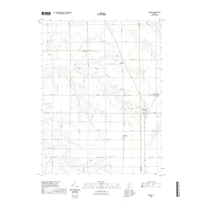
2021 Map of Medora
USGS Topo · Published 2021About this map
Macoupin Creek carves a winding path through this corner of the Illinois prairie, defining the borderlands where Jersey, Greene, and Macoupin Counties meet. The landscape is dotted with several small rural communities, including Medora, Kemper, Summerville, and Fidelity, each serving as a local anchor for the surrounding agricultural tracts. This 2021 update reveals a high density of ancestral burial grounds, offering significant value for genealogists tracing families in the region. Names like the Pruitt Cem, Rhoads Cem, and Longwill Cem are preserved here, alongside others such as Maple Lawn Cem and Elliott Cem. The map provides a clear look at the modern road network, from the intersection of Ruyle Rd to the more remote paths of W Range Line Rd, illustrating how early settlement patterns along the creeks have evolved into the contemporary township structure.
Find a feature on this map
69 named features on this map. Tap any name to fly to it.
Don’t see what you’re looking for? This feature index may not catch every label — zoom into the map to look around manually.
Map Details
Editions of this 2021 Medora Map
This is the sole edition of this map. No revisions or reprints were ever made.
Other maps of this area

1924 · Roodhouse
USGS Topo · 1:62,500

1925 · Brighton
USGS Topo · 1:62,500

1926 · Roodhouse
USGS Topo · 1:62,500

1928 · Brighton
USGS Topo · 1:62,500

1930 · Jerseyville
USGS Topo · 1:62,500

1932 · Greenfield
USGS Topo · 1:62,500

1933 · Jerseyville
USGS Topo · 1:62,500

1948 · Quincy
USGS Topo · 1:250,000

1956 · Quincy
USGS Topo · 1:250,000
1982 · Summerville
USGS Topo · 1:24,000