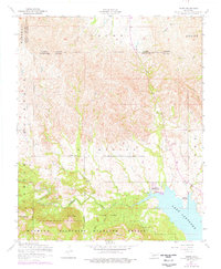
1956 Map of Meers
USGS Topo · Published 1976About this map
Wichita Mountains Wildlife Refuge dominates the southern landscape of this mid-century survey, showcasing a terrain of granite peaks and deep creek valleys in the heart of the Wichita range. High elevations such as Mount Scott and Mount Sheridan overlook the waters of Lake Lawtonka, while the small settlement of Meers serves as a focal point for local history along Medicine Creek. The presence of the Mount Scott Kiowa Mission and the Meers Cemetery provides specific points of interest for genealogists tracing families in this area of Comanche and Caddo counties.
Find a feature on this map
28 named features on this map. Tap any name to fly to it.
Don’t see what you’re looking for? This feature index may not catch every label — zoom into the map to look around manually.
Map Details
Editions of this 1956 Meers Map
2 editions found

Other maps of this area

1937 · Cache
USGS Topo · 1:48,000

1937 · Quanah Mountain
USGS Topo · 1:24,000

1942 · Cache
USGS Topo · 1:62,500

1946 · Lawton
USGS Topo · 1:62,500

1949 · Mount Scott
USGS Topo · 1:24,000

1949 · Quanah Mountain
USGS Topo · 1:24,000

1949 · Fort Sill
USGS Topo · 1:24,000

1950 · Saddle Mountain
USGS Topo · 1:62,500

1955 · Lawton
USGS Topo · 1:250,000

1956 · Saddle Mountain
USGS Topo · 1:24,000