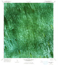
1973 Map of Melaleuca Head
USGS Topo · Published 1993About this map
Melaleuca Airboat Trail and several other specialized watercraft paths weave through this orthophotomap of the central Florida Everglades. The landscape is dominated by the Conservation Area No 3A, part of the larger Everglades Wildlife Management Area. This specific 1970s survey illustrates a region where water levels are managed by human intervention, as noted by the water impounded periodically in this area.
Find a feature on this map
9 named features on this map. Tap any name to fly to it.
Don’t see what you’re looking for? This feature index may not catch every label — zoom into the map to look around manually.
Map Details
Editions of this 1973 Melaleuca Head Map
2 editions found
Other maps of this area

1956 · Miami
USGS Topo · 1:250,000

1956 · West Palm Beach
USGS Topo · 1:250,000

1957 · West Palm Beach
USGS Topo · 1:250,000

1958 · West Palm Beach
USGS Topo · 1:250,000

1958 · Miami
USGS Topo · 1:250,000

1973 · Custard Apple Hammock
USGS Topo · 1:24,000

1973 · West Of Pennsuco
USGS Topo · 1:24,000

1973 · Everglades 4 NW
USGS Topo · 1:24,000

1973 · Everglades 4 NE
USGS Topo · 1:24,000

1973 · Everglades 4 SE
USGS Topo · 1:24,000