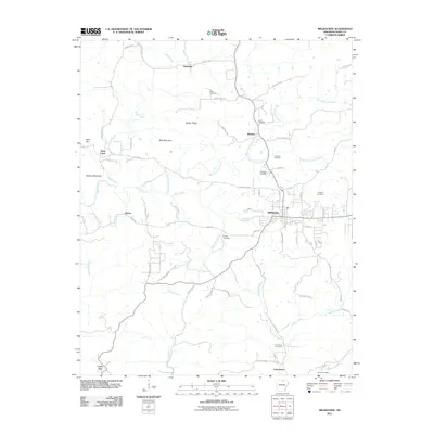
2011 Map of Melbourne
USGS Topo · Published 2011About this map
Melbourne serves as the central hub of Izard County, Arkansas, in this 2011 survey, situated within a landscape defined by the drainage systems of Big Hurricane Creek and Mill Creek. The settlement pattern follows the area’s ridge-and-hollow topography, with established communities like Newburg and Belview connected by an extensive network of county roads. Family history and local heritage are well-preserved across the quadrangle, evident in the numerous burial grounds such as Page Cemetery, Jones Cemetery, and Mayfield Cemetery. The terrain transitions from the heights of Bald Mountain and Hunters Mountain down to the southern lowlands around Lunenburg, where the West Rocky Bayou and Haley Creek converge. This map provides a detailed view of the modern rural infrastructure, capturing the enduring presence of small settlements like Jumbo and Lone Star alongside newer residential developments on the outskirts of the county seat.
Find a feature on this map
71 named features on this map. Tap any name to fly to it.
Don’t see what you’re looking for? This feature index may not catch every label — zoom into the map to look around manually.
Map Details
Editions of this 2011 Melbourne Map
This is the sole edition of this map. No revisions or reprints were ever made.
Other maps of this area

1890 · Batesville
USGS Topo · 1:125,000

1890 · Mountain Home
USGS Topo · 1:125,000

1891 · Mountain Home
USGS Topo · 1:125,000

1891 · Batesville
USGS Topo · 1:125,000

1892 · Mountain View
USGS Topo · 1:125,000

1894 · Mountain View
USGS Topo · 1:125,000

1894 · Mountain Home
USGS Topo · 1:125,000

1942 · Mt Pleasant
USGS Topo · 1:31,680

1945 · Harrison
USGS Topo · 1:250,000

1949 · Harrison
USGS Topo · 1:250,000