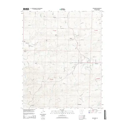
2014 Map of Melbourne
USGS Topo · Published 2014About this map
Melbourne serves as the focal point of this Izard County landscape, situated where several creeks and ridges converge in north-central Arkansas. The map illustrates a developed local infrastructure including Ozarka Coll and a local Water Plant near the center of town. Radiating outward from this hub, small communities such as Newburg, Jumbo, and Belview are connected by a network of state roads like Ar-9. The terrain is defined by distinct landmarks such as Brushy Ridge, Byler Hill, and Hunters Mtn, which separate the various drainages of Hurricane Creek and Mill Creek. This 2014 survey reveals a high density of family and community cemeteries, including Page Cem, Jones Cem, and the Lunenburg Cem near the southern settlement of Lunenburg. These sites, along with named springs like Powell Spring, indicate a long history of rural settlement and land use maintained into the modern era.
Find a feature on this map
101 named features on this map. Tap any name to fly to it.
Don’t see what you’re looking for? This feature index may not catch every label — zoom into the map to look around manually.
Map Details
Editions of this 2014 Melbourne Map
This is the sole edition of this map. No revisions or reprints were ever made.
Other maps of this area

1890 · Batesville
USGS Topo · 1:125,000

1890 · Mountain Home
USGS Topo · 1:125,000

1891 · Mountain Home
USGS Topo · 1:125,000

1891 · Batesville
USGS Topo · 1:125,000

1892 · Mountain View
USGS Topo · 1:125,000

1894 · Mountain View
USGS Topo · 1:125,000

1894 · Mountain Home
USGS Topo · 1:125,000

1942 · Mt Pleasant
USGS Topo · 1:31,680

1945 · Harrison
USGS Topo · 1:250,000

1949 · Harrison
USGS Topo · 1:250,000