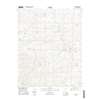
2017 Map of Melbourne
USGS Topo · Published 2017About this map
Melbourne serves as a central hub in Izard County, organized around a traditional street grid and the campus of Ozarka Coll. The surrounding landscape is defined by the dissection of the Ozark foothills by a complex network of waterways, including Big Hurricane Cr and W Rocky Bayou. The settlement pattern is characterized by small, dispersed communities like Newburg, Jumbo, and Lone Star, often situated near prominent terrain features such as Bald Mtn and Brushy Ridge. Genealogy and local history are well-represented by numerous family and community burial grounds, including Jones Cem, Bigham Cem, and Lunenburg Cem. Notable natural landmarks such as Powell Spring and the drainage of Wideman Cr illustrate the region's reliance on its varied water resources for early development and agriculture.
Find a feature on this map
90 named features on this map. Tap any name to fly to it.
Don’t see what you’re looking for? This feature index may not catch every label — zoom into the map to look around manually.
Map Details
Editions of this 2017 Melbourne Map
This is the sole edition of this map. No revisions or reprints were ever made.
Other maps of this area

1890 · Batesville
USGS Topo · 1:125,000

1890 · Mountain Home
USGS Topo · 1:125,000

1891 · Mountain Home
USGS Topo · 1:125,000

1891 · Batesville
USGS Topo · 1:125,000

1892 · Mountain View
USGS Topo · 1:125,000

1894 · Mountain View
USGS Topo · 1:125,000

1894 · Mountain Home
USGS Topo · 1:125,000

1942 · Mt Pleasant
USGS Topo · 1:31,680

1945 · Harrison
USGS Topo · 1:250,000

1949 · Harrison
USGS Topo · 1:250,000