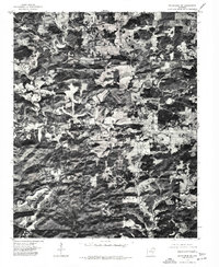
1976 Map of Melbourne SW
USGS Topo · Published 1977About this map
Melbourne serves as the primary focal point of this orthophotoquad, which captures the intersection of clearings and wooded drainages in the Ozark Foothills during the mid-1970s. This specific type of survey combines the precision of a topographic grid with the raw detail of an aerial photograph, revealing the literal footprint of the town and its outlying homesteads. The imagery shows a distinct pattern of land use where agricultural plots are carved out of the denser timber along the ridges. Because this is an orthophotograph rather than a traditional line-and-symbol map, researchers can observe the exact density of buildings and the layout of individual farmsteads around Melbourne as they appeared in January 1976.
Find a feature on this map
1 named feature on this map. Tap any name to fly to it.
Don’t see what you’re looking for? This feature index may not catch every label — zoom into the map to look around manually.
Map Details
Editions of this 1976 Melbourne SW Map
This is the sole edition of this map. No revisions or reprints were ever made.
Other maps of this area

1890 · Batesville
USGS Topo · 1:125,000

1890 · Mountain Home
USGS Topo · 1:125,000

1891 · Mountain Home
USGS Topo · 1:125,000

1891 · Batesville
USGS Topo · 1:125,000

1892 · Mountain View
USGS Topo · 1:125,000

1894 · Mountain View
USGS Topo · 1:125,000

1894 · Mountain Home
USGS Topo · 1:125,000

1942 · Mt Pleasant
USGS Topo · 1:31,680

1945 · Harrison
USGS Topo · 1:250,000

1949 · Harrison
USGS Topo · 1:250,000