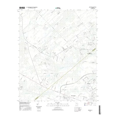
2017 Map of Meldrim
USGS Topo · Published 2017About this map
Meldrim and Bloomingdale anchor this landscape along the Effingham Co Chatham Co border, where the coastal plains are defined by an intricate network of waterways. The Little Ogeechee River and the Hardin Canal reflect the drainage patterns essential to the region's development, connecting various low-lying areas. The terrain is marked by significant wetlands, including Hardin Swamp, Walthour Swamp, and Three Men Swamp, illustrating the saturated environment that influenced local settlement and infrastructure placement.
Find a feature on this map
156 named features on this map. Tap any name to fly to it.
Don’t see what you’re looking for? This feature index may not catch every label — zoom into the map to look around manually.
Map Details
Editions of this 2017 Meldrim Map
This is the sole edition of this map. No revisions or reprints were ever made.
Other maps of this area

1919 · Egypt
USGS Topo · 1:62,500

1920 · Hardeeville
USGS Topo · 1:62,500

1920 · Meldrim
USGS Topo · 1:62,500

1939 · Egypt
USGS Topo · 1:62,500

1942 · Meldrim
USGS Topo · 1:62,500

1942 · Savannah
USGS Topo · 1:62,500

1943 · Hardeeville
USGS Topo · 1:62,500

1943 · Egypt
USGS Topo · 1:62,500

1947 · Savannah
USGS Topo · 1:250,000

1948 · Savannah
USGS Topo · 1:250,000