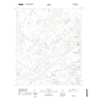
2020 Map of Meldrim
USGS Topo · Published 2020About this map
Bloomingdale and Meldrim anchor the western edge of this coastal Georgia landscape, where suburban growth from Savannah and Pooler meets a complex network of wetlands. The terrain is defined by its hydrology, ranging from the Little Ogeechee River and the engineered Hardin Canal to the dense, low-lying reaches of Skinners Bay, Three Men Swamp, and Walthour Swamp. For those tracing local heritage, several small burial sites are documented, including Hester Cem, Meldrim Cem, and Old Hill Cem. The map illustrates a region in transition, where established rural roads like Noel C Conaway Rd and Jabez Jones Rd now serve expanding residential developments at the periphery of Port Wentworth. The drainage patterns of Saint Augustine Cr and Spirit Branch provide a glimpse into the natural barriers that have shaped the footprint of these communities west of the coast.
Find a feature on this map
178 named features on this map. Tap any name to fly to it.
Don’t see what you’re looking for? This feature index may not catch every label — zoom into the map to look around manually.
Map Details
Editions of this 2020 Meldrim Map
This is the sole edition of this map. No revisions or reprints were ever made.
Other maps of this area

1919 · Egypt
USGS Topo · 1:62,500

1920 · Hardeeville
USGS Topo · 1:62,500

1920 · Meldrim
USGS Topo · 1:62,500

1939 · Egypt
USGS Topo · 1:62,500

1942 · Meldrim
USGS Topo · 1:62,500

1942 · Savannah
USGS Topo · 1:62,500

1943 · Hardeeville
USGS Topo · 1:62,500

1943 · Egypt
USGS Topo · 1:62,500

1947 · Savannah
USGS Topo · 1:250,000

1948 · Savannah
USGS Topo · 1:250,000