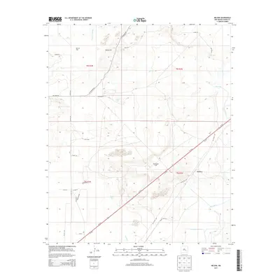
2013 Map of Melena
USGS Topo · Published 2013About this map
Melena occupies a central position in this Chaves County landscape, situated where the Old Clovis Hwy and Us-70 E traverse the arid terrain east of the Pecos River. The geography is defined by a series of intermittent watercourses and depressions, such as Arroyo del Macho and the curiously named Ink Pots to the northeast. These features, along with Skull Lake and Lowe Lake, suggest a basin-and-range hydrology where water is transient but influential on the land's use.
Find a feature on this map
34 named features on this map. Tap any name to fly to it.
Don’t see what you’re looking for? This feature index may not catch every label — zoom into the map to look around manually.
Map Details
Editions of this 2013 Melena Map
This is the sole edition of this map. No revisions or reprints were ever made.
Other maps of this area

1949 · Roswell North
USGS Topo · 1:24,000

1950 · Comanche Spring
USGS Topo · 1:24,000

1950 · Bitter Lake
USGS Topo · 1:24,000

1955 · Roswell
USGS Topo · 1:250,000

1958 · Roswell
USGS Topo · 1:250,000

1962 · Roswell
USGS Topo · 1:250,000
1962 · Roswell North
USGS Topo · 1:24,000

1962 · Eightmile Draw
USGS Topo · 1:24,000
1962 · Bitter Lake
USGS Topo · 1:24,000

1962 · Panther Hill
USGS Topo · 1:24,000