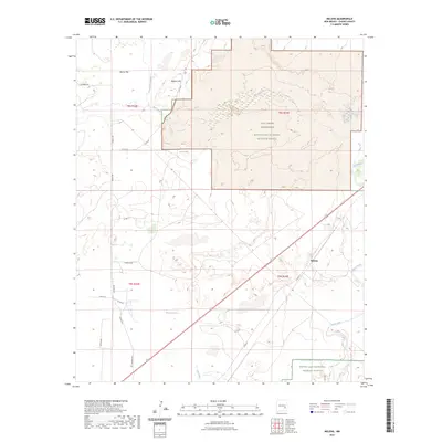
2023 Map of Melena
USGS Topo · Published 2023About this map
The Pecos River corridor defines this landscape in Chaves County, where the transition from arid flats to riparian wetlands creates a distinct ecological boundary. The Bitter Lake National Wildlife Refuge and the Salt Creek Wilderness dominate the eastern half of the map, protecting a series of unique aquatic features such as the Ink Pots and the serpentine course of Salt Creek. These water sources represent a critical intersection of desert and marshland in a region defined by its hydrology.
Find a feature on this map
27 named features on this map. Tap any name to fly to it.
Don’t see what you’re looking for? This feature index may not catch every label — zoom into the map to look around manually.
Map Details
Editions of this 2023 Melena Map
This is the sole edition of this map. No revisions or reprints were ever made.
Other maps of this area

1949 · Roswell North
USGS Topo · 1:24,000

1950 · Comanche Spring
USGS Topo · 1:24,000

1950 · Bitter Lake
USGS Topo · 1:24,000

1955 · Roswell
USGS Topo · 1:250,000

1958 · Roswell
USGS Topo · 1:250,000

1962 · Roswell
USGS Topo · 1:250,000
1962 · Roswell North
USGS Topo · 1:24,000

1962 · Eightmile Draw
USGS Topo · 1:24,000
1962 · Bitter Lake
USGS Topo · 1:24,000

1962 · Panther Hill
USGS Topo · 1:24,000