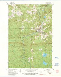
1967 Map of Mellen
USGS Topo · Published 1989About this map
Mellen serves as the focal point of this Ashland County landscape, situated at the confluence of the Bad River and Montreal Creek. The 1967 revision highlights a transition from the industrial activity of the Soo Line railroad and local quarries to the recreational development of Copper Falls State Park. The northern section is defined by the park’s waterfalls and the Mellen Country Club, while the southern reaches extend into the Chequamegon National Forest.
Find a feature on this map
34 named features on this map. Tap any name to fly to it.
Don’t see what you’re looking for? This feature index may not catch every label — zoom into the map to look around manually.
Map Details
Editions of this 1967 Mellen Map
2 editions found
Other maps of this area

1942 · Glidden
USGS Topo · 1:48,000

1942 · Clam Lake
USGS Topo · 1:48,000

1942 · Mellen
USGS Topo · 1:48,000

1942 · Marengo
USGS Topo · 1:48,000

1945 · Marengo
USGS Topo · 1:48,000

1945 · Clam Lake
USGS Topo · 1:48,000

1945 · Glidden
USGS Topo · 1:48,000

1945 · Mellen
USGS Topo · 1:48,000

1953 · Ashland
USGS Topo · 1:250,000
1956 · Mt. Whittlesey
USGS Topo · 1:24,000