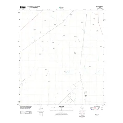
2010 Map of Melo
USGS Topo · Published 2010About this map
Sarco Cemetery and the nearby small settlement of Sarco anchor the southeast corner of this south Texas landscape, which is dominated by a sprawling network of ranchlands and hydraulic infrastructure. The map reveals a high concentration of named windmills, such as the Airfield Windmill, Brahman Windmill, and Coyote Windmill, highlighting the critical role of groundwater in sustaining the region's livestock economy. The drainage patterns of Sarco Creek, Martinez Creek, and Arroyocita Creek weave between established family holdings like the Melo Ranch and Bissitt Ranch. This survey provides researchers with a clear view of how large-scale Texas landholdings were managed and named at the opening of the 21st century, centered on the unincorporated community of Melo.
Find a feature on this map
41 named features on this map. Tap any name to fly to it.
Don’t see what you’re looking for? This feature index may not catch every label — zoom into the map to look around manually.
Map Details
Editions of this 2010 Melo Map
This is the sole edition of this map. No revisions or reprints were ever made.
Other maps of this area

1953 · Beeville
USGS Topo · 1:250,000

1954 · Skidmore
USGS Topo · 1:62,500

1954 · Refugio
USGS Topo · 1:62,500

1956 · Beeville
USGS Topo · 1:250,000

1960 · Beeville
USGS Topo · 1:250,000

1962 · Live Oak Lake
USGS Topo · 1:24,000

1962 · Melo
USGS Topo · 1:24,000

1962 · Hensley Lake
USGS Topo · 1:24,000

1962 · Goliad
USGS Topo · 1:24,000

1963 · Berclair
USGS Topo · 1:24,000