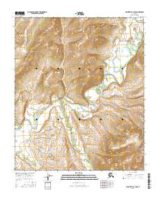
2016 Map of Melozitna A-4 NW
USGS Topo · Published 2016About this map
Wetlands and complex watercourses dominate the interior of Alaska in the T3s R19e and T3s R20e townships. This 2016 survey highlights a landscape defined by meandering river systems and the intricate drainage patterns characteristic of the Yukon-Koyukuk region. The Public Land Survey System grid overlays a terrain where water dictates the geography, showcasing the natural flow of the wilderness before significant human infrastructure. The boundary lines for T4s R19e and T4s R20e provide critical spatial reference for land management in this remote territory. Researchers can observe the natural shifts in hydrology and topographic contours that have shaped this portion of the Melozitna area over decades.
Find a feature on this map
4 named features on this map. Tap any name to fly to it.
Don’t see what you’re looking for? This feature index may not catch every label — zoom into the map to look around manually.
Map Details
Editions of this 2016 Melozitna A-4 NW Map
This is the sole edition of this map. No revisions or reprints were ever made.
Other maps of this area

1951 · Melozitna
USGS Topo · 1:250,000

1953 · Melozitna A-4
USGS Topo · 1:63,360
1954 · Melozitna A-5
USGS Topo · 1:63,360
1954 · Melozitna B-4
USGS Topo · 1:63,360
1954 · Melozitna B-5
USGS Topo · 1:63,360

1956 · Melozitna
USGS Topo · 1:250,000
2016 · Melozitna B-5 SE
USGS Topo · 1:25,000
2016 · Melozitna A-5 NE
USGS Topo · 1:25,000
2016 · Melozitna A-5 SE
USGS Topo · 1:25,000
2016 · Melozitna A-4 SW
USGS Topo · 1:25,000