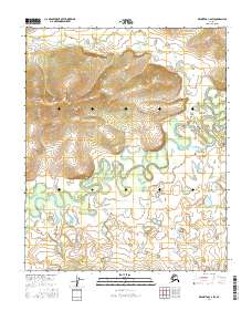
2016 Map of Melozitna C-2 SW
USGS Topo · Published 2016About this map
Meandering river systems and high ridge elevations define this portion of the Yukon-Koyukuk region. The landscape is structured by the Public Land Survey System, spanning townships from T3n R23e in the northwest down to T1n R25e in the southeast. This 2016 survey highlights the complex hydrology of the interior, where unnamed waterways loop through low-lying basins flanked by significant topographical rises. These natural corridors and elevation changes have historically dictated movement through the Alaskan bush, long before modern infrastructure reached these sections of T2n R24e and T2n R25e. The map serves as a primary reference for the drainage patterns and land divisions that characterize this uninhabited stretch of the Alaskan interior.
Find a feature on this map
9 named features on this map. Tap any name to fly to it.
Don’t see what you’re looking for? This feature index may not catch every label — zoom into the map to look around manually.
Map Details
Editions of this 2016 Melozitna C-2 SW Map
This is the sole edition of this map. No revisions or reprints were ever made.
Other maps of this area

1951 · Melozitna
USGS Topo · 1:250,000

1954 · Melozitna B-3
USGS Topo · 1:63,360

1954 · Melozitna C-3
USGS Topo · 1:63,360

1956 · Melozitna B-2
USGS Topo · 1:63,360
1956 · Melozitna C-2
USGS Topo · 1:63,360

1956 · Melozitna
USGS Topo · 1:250,000
2016 · Melozitna B-3 NE
USGS Topo · 1:25,000
2016 · Melozitna C-2 NW
USGS Topo · 1:25,000
2016 · Melozitna B-2 NW
USGS Topo · 1:25,000
2016 · Melozitna C-3 NE
USGS Topo · 1:25,000