
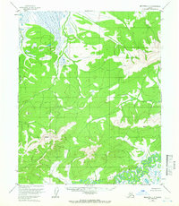
1954 Map of Melozitna C-3
USGS Topo · Published 1959About this map
Melozitna River meanders through the southern portion of this interior Alaskan wilderness, as it appeared during the mid-1950s. The landscape is defined by vast drainage systems and significant survey benchmarks, notably Vabm 2675 Zitna, which marks a prominent high point in the southwestern quadrant. To the east, Vabm 2000 Coy serves as another critical reference point for early topographic efforts. The northern wetlands are drained by Kitalitna Creek, while the southeastern corner is shaped by the confluence near Dome Creek. This sheet represents a period of intensive aerial photogrammetric survey in the Yukon-Koyukuk region, capturing the complex natural contours and watercourses of the subarctic terrain before more modern human alterations or naming conventions were established.
Find a feature on this map
6 named features on this map. Tap any name to fly to it.
Don’t see what you’re looking for? This feature index may not catch every label — zoom into the map to look around manually.
Map Details
Editions of this 1954 Melozitna C-3 Map
2 editions found
Other maps of this area

1951 · Melozitna
USGS Topo · 1:250,000

1952 · Melozitna D-3
USGS Topo · 1:63,360

1954 · Melozitna B-3
USGS Topo · 1:63,360

1954 · Melozitna C-4
USGS Topo · 1:63,360
1954 · Melozitna B-4
USGS Topo · 1:63,360

1954 · Melozitna D-4
USGS Topo · 1:63,360

1954 · Melozitna D-3
USGS Topo · 1:63,360

1955 · Melozitna D-2
USGS Topo · 1:63,360

1956 · Melozitna B-2
USGS Topo · 1:63,360
1956 · Melozitna C-2
USGS Topo · 1:63,360