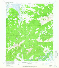
1954 Map of Melozitna C-3
USGS Topo · Published 1966About this map
Melozitna River meanders through this interior Alaska landscape, defining a complex system of oxbows and wetlands in the southeastern quadrant. Photogrammetric methods from 1952 capture a wilderness devoid of roads or permanent settlements, where the drainage patterns of Kitalitna Creek and Dome Creek dictate the terrain. High points are meticulously recorded by triangulation stations such as VABM 2575 Zina and VABM 2000 Coy, which served as critical survey benchmarks during this mid-century effort by the Bureau of Land Management and the Geological Survey. The presence of Lost Lake and various unnamed ponds amidst the marshy lowlands highlights the transition from upland ridges to the river valley, offering a precise look at the hydrology of the Yukon-Koyukuk region before any modern industrial footprint.
Find a feature on this map
7 named features on this map. Tap any name to fly to it.
Don’t see what you’re looking for? This feature index may not catch every label — zoom into the map to look around manually.
Map Details
Editions of this 1954 Melozitna C-3 Map
2 editions found
Other maps of this area

1951 · Melozitna
USGS Topo · 1:250,000

1952 · Melozitna D-3
USGS Topo · 1:63,360

1954 · Melozitna B-3
USGS Topo · 1:63,360

1954 · Melozitna C-4
USGS Topo · 1:63,360
1954 · Melozitna B-4
USGS Topo · 1:63,360

1954 · Melozitna D-4
USGS Topo · 1:63,360

1954 · Melozitna C-3
USGS Topo · 1:63,360

1954 · Melozitna D-3
USGS Topo · 1:63,360

1955 · Melozitna D-2
USGS Topo · 1:63,360

1956 · Melozitna B-2
USGS Topo · 1:63,360