
1954 Map of Melozitna B-3
USGS Topo · Published 1958About this map
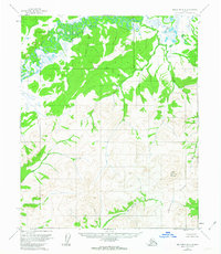
The Melozitna River meanders across a vast wetland plain in this interior Alaska landscape, providing a sharp contrast to the high, unglaciated terrain of the Kokrines Hills to the south. The mapping, based on 1952 aerial photography, captures a wilderness defined by its complex drainage systems where the West Fork and Wolf Creek gather from the slopes of Wolf Mountain. The lack of any marked roads or permanent settlements in this mid-century survey emphasizes the seasonal and itinerant nature of land use in the region. Notable hydrological features like Hot Springs Creek suggest the thermal activity characteristic of this part of the Yukon-Koyukuk region, while the North Fork and Big Creek provide further evidence of the dense network of waterways that once served as the primary transit corridors for miners and indigenous travelers alike.
Find a feature on this map
9 named features on this map. Tap any name to fly to it.
Don’t see what you’re looking for? This feature index may not catch every label — zoom into the map to look around manually.
Map Details
Editions of this 1954 Melozitna B-3 Map
2 editions found
Other maps of this area

1951 · Melozitna
USGS Topo · 1:250,000

1952 · Melozitna A-2
USGS Topo · 1:63,360

1953 · Melozitna A-4
USGS Topo · 1:63,360

1953 · Melozitna A-2
USGS Topo · 1:63,360
1954 · Melozitna A-3
USGS Topo · 1:63,360

1954 · Melozitna C-4
USGS Topo · 1:63,360
1954 · Melozitna B-4
USGS Topo · 1:63,360

1954 · Melozitna C-3
USGS Topo · 1:63,360

1956 · Melozitna B-2
USGS Topo · 1:63,360
1956 · Melozitna C-2
USGS Topo · 1:63,360