
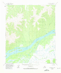
1953 Map of Melozitna A-2
USGS Topo · Published 1973About this map
Yukon River dominates the southern half of this interior Alaskan survey, carving a complex network of channels, bars, and seasonal sloughs. The settlement at Birches sits on the northern bank, supported by a nearby Landing Strip and a Native Fishing Camp located just downstream. This area represents a classic riverine subsistence landscape, where travel and industry are dictated by the water. To the north, the terrain rises sharply toward Gold Mountain, where numerous drainages like Hudson Creek and Birches Creek flow south to join the main river system.
Find a feature on this map
24 named features on this map. Tap any name to fly to it.
Don’t see what you’re looking for? This feature index may not catch every label — zoom into the map to look around manually.
Map Details
Editions of this 1953 Melozitna A-2 Map
2 editions found
Other maps of this area

1951 · Ruby
USGS Topo · 1:250,000

1951 · Melozitna
USGS Topo · 1:250,000

1952 · Melozitna A-2
USGS Topo · 1:63,360

1952 · Ruby D-1
USGS Topo · 1:63,360

1952 · Ruby D-3
USGS Topo · 1:63,360

1952 · Ruby D-2
USGS Topo · 1:63,360

1952 · Ruby
USGS Topo · 1:250,000

1952 · Melozitna A-1
USGS Topo · 1:63,360

1954 · Melozitna B-3
USGS Topo · 1:63,360
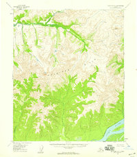
1954 · Melozitna A-3
USGS Topo · 1:63,360