
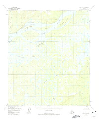
1952 Map of Ruby D-3
USGS Topo · Published 1957About this map
The Yukon River dominates this mid-century landscape, branching into the Main Channel, Western Channel, and East Channel around a complex system of river islands. Landforms like Florence Island, Doyle Island, and Edith Island are defined by shifting waterways and sloughs, including Kathaleen Island Slough and Novakaket Slough. To the south, the Nowitna River and Junekaket Creek snake through a water-heavy basin, featuring extreme meanders such as The Loop.
Find a feature on this map
23 named features on this map. Tap any name to fly to it.
Don’t see what you’re looking for? This feature index may not catch every label — zoom into the map to look around manually.
Map Details
Editions of this 1952 Ruby D-3 Map
2 editions found
Other maps of this area

1951 · Ruby
USGS Topo · 1:250,000

1951 · Melozitna
USGS Topo · 1:250,000

1952 · Ruby D-4
USGS Topo · 1:63,360

1952 · Ruby C-3
USGS Topo · 1:63,360

1952 · Melozitna A-2
USGS Topo · 1:63,360

1952 · Ruby C-2
USGS Topo · 1:63,360

1952 · Ruby D-2
USGS Topo · 1:63,360

1952 · Ruby C-4
USGS Topo · 1:63,360

1952 · Ruby
USGS Topo · 1:250,000

1953 · Melozitna A-4
USGS Topo · 1:63,360