
1952 Map of Ruby D-2
USGS Topo · Published 1957About this map
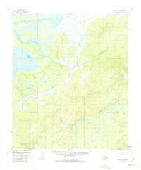
Mud River flows through the southeastern portion of this interior Alaskan landscape, defining a wide basin of wetlands and intricate drainage patterns. The topography, mapped from 1952 aerial photography, transitions from the low-lying marshes of the river valley toward the elevated terrain of the Yukon-Koyukuk region. In the northeast, Bering Creek carves a path through the uplands, while the survey point VABM 1149 Little stands as a primary landmark in the center-right of the quadrangle. This 1950s survey captures the area before any established roads or trails were documented, showing a wilderness state where travel was dictated entirely by the winding waterways and the natural contours of the hills.
Find a feature on this map
3 named features on this map. Tap any name to fly to it.
Don’t see what you’re looking for? This feature index may not catch every label — zoom into the map to look around manually.
Map Details
Editions of this 1952 Ruby D-2 Map
4 editions found
Other maps of this area

1951 · Ruby
USGS Topo · 1:250,000

1951 · Melozitna
USGS Topo · 1:250,000

1952 · Ruby C-3
USGS Topo · 1:63,360

1952 · Ruby C-1
USGS Topo · 1:63,360

1952 · Melozitna A-2
USGS Topo · 1:63,360

1952 · Ruby D-1
USGS Topo · 1:63,360

1952 · Ruby C-2
USGS Topo · 1:63,360

1952 · Ruby D-3
USGS Topo · 1:63,360

1952 · Ruby
USGS Topo · 1:250,000

1952 · Melozitna A-1
USGS Topo · 1:63,360