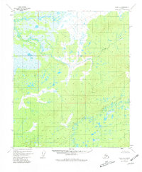
1952 Map of Ruby D-2
USGS Topo · Published 1981About this map
The Mud River dominates the lowlands of this Alaskan interior landscape, winding through a complex network of wetlands and muskeg. In the early 1950s, this region remained largely unsurveyed on the ground, with the U.S. Geological Survey relying on photogrammetric methods from aerial photography to chart the intricate drainage patterns. The map documents the meandering path of Bering Creek as it feeds into the broader river system, illustrating a wilderness shaped by water and seasonal change. A solitary geodetic marker, VABM 1149 Little, provides one of the few fixed points of reference in a terrain defined by shifting shorelines and countless unnamed ponds. The presence of predetermined land lines from the Bureau of Land Management Folio K-10 indicates early administrative efforts to organize this remote territory before formal ground surveys were completed.
Find a feature on this map
3 named features on this map. Tap any name to fly to it.
Don’t see what you’re looking for? This feature index may not catch every label — zoom into the map to look around manually.
Map Details
Editions of this 1952 Ruby D-2 Map
4 editions found
Other maps of this area

1951 · Ruby
USGS Topo · 1:250,000

1951 · Melozitna
USGS Topo · 1:250,000

1952 · Ruby C-3
USGS Topo · 1:63,360

1952 · Ruby C-1
USGS Topo · 1:63,360

1952 · Melozitna A-2
USGS Topo · 1:63,360

1952 · Ruby D-1
USGS Topo · 1:63,360

1952 · Ruby C-2
USGS Topo · 1:63,360

1952 · Ruby D-3
USGS Topo · 1:63,360

1952 · Ruby D-2
USGS Topo · 1:63,360

1952 · Ruby
USGS Topo · 1:250,000