
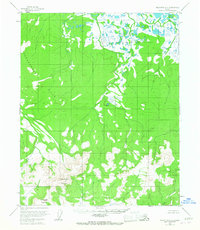
1954 Map of Melozitna C-4
USGS Topo · Published 1959About this map
Hochandochtla Mountain and Anotleneega Mountain anchor the southern reaches of this interior Alaskan wilderness, rising above a complex network of wetlands and tundra drainage. Surveyed in the mid-1950s, the landscape is defined by the massive Tak Hakhdona Hills to the west and a dense cluster of ponds and lakes in the northeast that feed into Kitalitna Creek. The terrain shows no established roads or permanent settlements at the time of aerial photography, reflecting the area's isolation. Waterways such as Glacier Creek and Gikhdatitna Creek carve through the central highlands, providing the primary navigable paths through the dense contours. This map is a record of the Yukon-Koyukuk region before any modern industrial or infrastructure changes, showing the land as a purely topographical expanse of water and rock.
Find a feature on this map
6 named features on this map. Tap any name to fly to it.
Don’t see what you’re looking for? This feature index may not catch every label — zoom into the map to look around manually.
Map Details
Editions of this 1954 Melozitna C-4 Map
2 editions found
Other maps of this area

1951 · Melozitna
USGS Topo · 1:250,000

1952 · Melozitna D-3
USGS Topo · 1:63,360

1954 · Melozitna B-3
USGS Topo · 1:63,360
1954 · Melozitna B-4
USGS Topo · 1:63,360

1954 · Melozitna C-5
USGS Topo · 1:63,360

1954 · Melozitna D-5
USGS Topo · 1:63,360
1954 · Melozitna B-5
USGS Topo · 1:63,360

1954 · Melozitna D-4
USGS Topo · 1:63,360

1954 · Melozitna C-3
USGS Topo · 1:63,360

1954 · Melozitna D-3
USGS Topo · 1:63,360