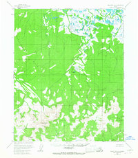
1954 Map of Melozitna C-4
USGS Topo · Published 1967About this map
Anotleneega Mountain and Hochandochtla Mountain dominate the southern interior of this Alaskan interior landscape, rising above a network of drainages that feed the region's river systems. Mapped during the mid-1950s using photogrammetric methods, the terrain is characterized by the broad Takhakhdna Hills to the west and a complex of wetlands to the north. Waterways such as Grikhaatitna Creek and Kitalitna Creek wind through the north-central and northeastern sectors, illustrating the drainage patterns of the Glacier Creek watershed. This survey captures the remote wilderness of the Yukon-Koyukuk region before significant modern development, showing the land as it was documented by the Bureau of Land Management and the Geological Survey for resource and topographical records.
Find a feature on this map
6 named features on this map. Tap any name to fly to it.
Don’t see what you’re looking for? This feature index may not catch every label — zoom into the map to look around manually.
Map Details
Editions of this 1954 Melozitna C-4 Map
2 editions found
Other maps of this area

1951 · Melozitna
USGS Topo · 1:250,000

1952 · Melozitna D-3
USGS Topo · 1:63,360

1954 · Melozitna B-3
USGS Topo · 1:63,360

1954 · Melozitna C-4
USGS Topo · 1:63,360
1954 · Melozitna B-4
USGS Topo · 1:63,360

1954 · Melozitna C-5
USGS Topo · 1:63,360

1954 · Melozitna D-5
USGS Topo · 1:63,360
1954 · Melozitna B-5
USGS Topo · 1:63,360

1954 · Melozitna D-4
USGS Topo · 1:63,360

1954 · Melozitna C-3
USGS Topo · 1:63,360