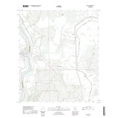
2018 Map of Melville
USGS Topo · Published 2018About this map
The Atchafalaya River winds through the heart of this riverine landscape, defining the boundary between St. Landry and Pointe Coupee Parishes. The town of Melville sits on the western bank, its grid of streets like Walnut St and S Gum St clustered near the Melville Crevasse, a notable geographic mark of past levee breaches. East of the river, the expansive Morganza Floodway dominates the terrain, a complex network of wetlands and drainage channels including Bayou Cross Vine, Bayou Latanache, and Bayou Pays Bas. Small settlements like Ravenswood and Argyle are positioned along the primary road corridors such as State Rte 77. The map illustrates the sophisticated flood control infrastructure of the basin, where winding bayous like Bayou Bilboquet and Johnson Bayou coexist with an extensive levee system and rural routes like Bayou Fordoche Rd.
Find a feature on this map
48 named features on this map. Tap any name to fly to it.
Don’t see what you’re looking for? This feature index may not catch every label — zoom into the map to look around manually.
Map Details
Editions of this 2018 Melville Map
This is the sole edition of this map. No revisions or reprints were ever made.
Other maps of this area

1939 · Fordoche
USGS Topo · 1:62,500

1941 · Batchelor
USGS Topo · 1:62,500

1954 · Fordoche
USGS Topo · 1:24,000

1954 · Baton Rouge
USGS Topo · 1:250,000

1955 · Fordoche
USGS Topo · 1:62,500

1955 · Batchelor
USGS Topo · 1:62,500

1955 · Odenburg
USGS Topo · 1:62,500

1956 · Baton Rouge
USGS Topo · 1:250,000

1959 · Fordoche
USGS Topo · 1:62,500

1959 · Palmetto
USGS Topo · 1:62,500