
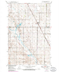
1950 Map of Melville
USGS Topo · Published 1950About this map
Melville serves as the central hub of this mid-century prairie landscape, situated along the Northern Pacific railroad line. The surrounding countryside is defined by a dense network of local education centers, including School No 1, School No 2, School No 3, and School No 4, which suggests a well-distributed agricultural community. The terrain is marked by the winding path of Pipestem Creek and the presence of Lake Bonita, providing essential water sources in this region of the Missouri River Basin. Township divisions such as Walters, Glacier, and Bordulac illustrate the organized land management of the era. Evidence of early rural infrastructure is visible through several marked Windmill locations, highlighting the reliance on groundwater for the homesteads and farms scattered across the Foster and Stutsman County border.
Find a feature on this map
14 named features on this map. Tap any name to fly to it.
Don’t see what you’re looking for? This feature index may not catch every label — zoom into the map to look around manually.
Map Details
Editions of this 1950 Melville Map
2 editions found
Other maps of this area

1900 · Pingree
USGS Topo · 1:125,000

1900 · Pingree
USGS Topo · 1:62,500

1948 · Carrington
USGS Topo · 1:62,500

1950 · Carrington East
USGS Topo · 1:24,000

1950 · Carrington SW
USGS Topo · 1:24,000

1950 · Carrington West
USGS Topo · 1:24,000

1951 · Pingree
USGS Topo · 1:24,000

1951 · Bordulac SW
USGS Topo · 1:24,000
1951 · Bordulac
USGS Topo · 1:24,000

1952 · New Rockford
USGS Topo · 1:250,000