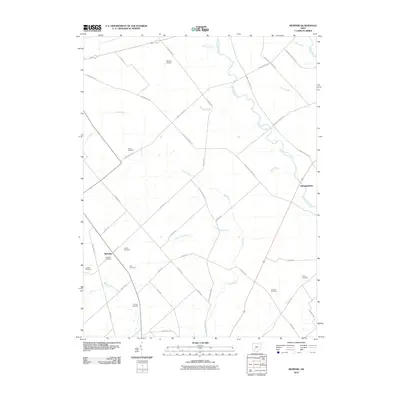
2010 Map of Memphis
USGS Topo · Published 2010About this map
Memphis and Georgetown anchor this agricultural landscape in Clinton County, where a dense network of country roads defines the rural character of early 21st-century Ohio. The terrain is marked by an extensive system of water management, including Persinger Ditch, Waddle Ditch, and Hicks Ditch, which support the surrounding farmsteads. These man-made channels feed into larger natural waterways like Rattlesnake Creek and Lees Creek, illustrating the long-standing efforts to drain the fertile till plains for cultivation.
Find a feature on this map
50 named features on this map. Tap any name to fly to it.
Don’t see what you’re looking for? This feature index may not catch every label — zoom into the map to look around manually.
Map Details
Editions of this 2010 Memphis Map
This is the sole edition of this map. No revisions or reprints were ever made.
Other maps of this area

1906 · Mt Sterling
USGS Topo · 1:62,500

1916 · Octa
USGS Topo · 1:62,500

1917 · Greenfield
USGS Topo · 1:62,500

1917 · Sabina
USGS Topo · 1:62,500

1943 · Sabina
USGS Topo · 1:62,500

1944 · Greenfield
USGS Topo · 1:62,500

1944 · Octa
USGS Topo · 1:62,500

1947 · Columbus
USGS Topo · 1:250,000

1960 · Greenfield
USGS Topo · 1:24,000
1960 · Leesburg
USGS Topo · 1:24,000