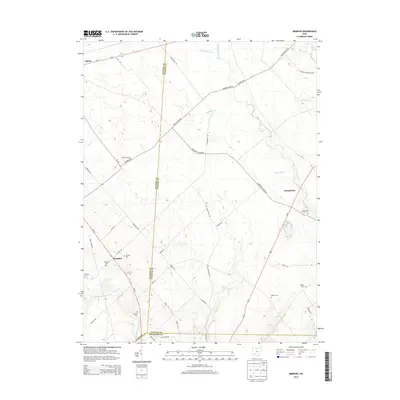
2013 Map of Memphis
USGS Topo · Published 2013About this map
Memphis sits at the convergence of several rural thoroughfares in this early 21st-century agricultural landscape, where the borders of Clinton, Fayette, and Highland counties meet. The area is defined by a dense network of family and community burial grounds, including Richland Cem, Luttrell Cem, and the Jeff Cem, which suggest generations of local settlement. To the northwest, the town of Sabina marks a larger population center, while Georgetown occupies the eastern portion of the quadrangle along Us-62.
Find a feature on this map
60 named features on this map. Tap any name to fly to it.
Don’t see what you’re looking for? This feature index may not catch every label — zoom into the map to look around manually.
Map Details
Editions of this 2013 Memphis Map
This is the sole edition of this map. No revisions or reprints were ever made.
Other maps of this area

1906 · Mt Sterling
USGS Topo · 1:62,500

1916 · Octa
USGS Topo · 1:62,500

1917 · Greenfield
USGS Topo · 1:62,500

1917 · Sabina
USGS Topo · 1:62,500

1943 · Sabina
USGS Topo · 1:62,500

1944 · Greenfield
USGS Topo · 1:62,500

1944 · Octa
USGS Topo · 1:62,500

1947 · Columbus
USGS Topo · 1:250,000

1960 · Greenfield
USGS Topo · 1:24,000
1960 · Leesburg
USGS Topo · 1:24,000