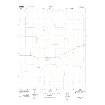
2010 Map of Memphis NW
USGS Topo · Published 2010About this map
Lakeview serves as the central hub of this Hall County landscape, situated where the grid of rural roads meets the branching drainage of Oaks Creek. The settlement's street plan is clearly delineated, providing a detailed look at the community's layout in the early 21st century. To the northeast, the smaller locality of Eli sits along the highway, while the surrounding territory is defined by a dense network of Farm to Market roads, including FM 3517 and FM 2472.
Find a feature on this map
24 named features on this map. Tap any name to fly to it.
Don’t see what you’re looking for? This feature index may not catch every label — zoom into the map to look around manually.
Map Details
Editions of this 2010 Memphis NW Map
This is the sole edition of this map. No revisions or reprints were ever made.
Other maps of this area

1954 · Plainview
USGS Topo · 1:250,000

1958 · Plainview
USGS Topo · 1:250,000

1960 · Brice
USGS Topo · 1:62,500

1961 · Memphis
USGS Topo · 1:62,500

1963 · Hedley
USGS Topo · 1:24,000

1963 · Clarendon SE
USGS Topo · 1:24,000

1963 · Giles
USGS Topo · 1:24,000

1976 · Brice SE
USGS Topo · 1:24,000

1976 · Memphis NW
USGS Topo · 1:24,000
1976 · Brice NE
USGS Topo · 1:24,000