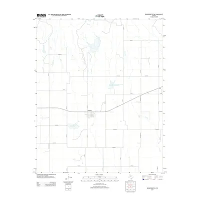
2012 Map of Memphis NW
USGS Topo · Published 2012About this map
The town of Lakeview serves as a central point in this part of Hall County, Texas, defined by a structured grid of streets surrounded by expansive rural land. The landscape is marked by the seasonal and intermittent drainage patterns of Oaks Cr and Spring Creek, which are critical to the agricultural life of this semi-arid region. Of particular interest is the Deaver Soil Conservation Service Springs Site 15 Reservoir, an indicator of mid-century efforts to manage water resources and soil erosion across the Texas Panhandle. A network of rural routes, including Farm Road 2472 and several county roads like Cord 18, connects the town to outlying areas such as the small settlement of Eli to the east. The map records a moment in the early 21st century when these traditional agricultural patterns remained the dominant feature of the local geography.
Find a feature on this map
23 named features on this map. Tap any name to fly to it.
Don’t see what you’re looking for? This feature index may not catch every label — zoom into the map to look around manually.
Map Details
Editions of this 2012 Memphis NW Map
This is the sole edition of this map. No revisions or reprints were ever made.
Other maps of this area

1954 · Plainview
USGS Topo · 1:250,000

1958 · Plainview
USGS Topo · 1:250,000

1960 · Brice
USGS Topo · 1:62,500

1961 · Memphis
USGS Topo · 1:62,500

1963 · Hedley
USGS Topo · 1:24,000

1963 · Clarendon SE
USGS Topo · 1:24,000

1963 · Giles
USGS Topo · 1:24,000

1976 · Brice SE
USGS Topo · 1:24,000

1976 · Memphis NW
USGS Topo · 1:24,000
1976 · Brice NE
USGS Topo · 1:24,000