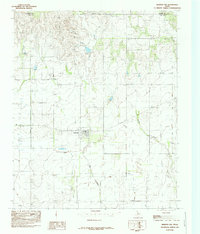
1985 Map of Memphis NW
USGS Topo · Published 1985About this map
Lakeview occupies the central prairie of the Texas Panhandle in this mid-1980s provisional survey, showing a clustered grid of streets surrounded by expansive rangeland. The landscape is defined by the headwaters of the Red River basin, where Oaks Creek and Spring Creek carve winding paths through the terrain. Evidence of rural life and mortality is marked by the Cem just west of the town center, a key site for genealogical research in this part of Hall County. The presence of numerous Well and Wells labels across the quadrangle indicates the critical importance of groundwater management for the local ranching and agricultural economy. Straddling the boundary between Donley Co and Hall Co, the map documents a sparse but vital network of improved roads connecting isolated homesteads and water sources.
Find a feature on this map
7 named features on this map. Tap any name to fly to it.
Don’t see what you’re looking for? This feature index may not catch every label — zoom into the map to look around manually.
Map Details
Editions of this 1985 Memphis NW Map
This is the sole edition of this map. No revisions or reprints were ever made.
Other maps of this area

1954 · Plainview
USGS Topo · 1:250,000

1958 · Plainview
USGS Topo · 1:250,000

1960 · Brice
USGS Topo · 1:62,500

1961 · Memphis
USGS Topo · 1:62,500

1963 · Hedley
USGS Topo · 1:24,000

1963 · Clarendon SE
USGS Topo · 1:24,000

1963 · Giles
USGS Topo · 1:24,000

1976 · Brice SE
USGS Topo · 1:24,000

1976 · Memphis NW
USGS Topo · 1:24,000
1976 · Brice NE
USGS Topo · 1:24,000