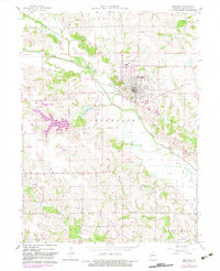
1965 Map of Memphis
USGS Topo · Published 1983About this map
Memphis serves as the central hub of this Scotland County survey, which documents the landscape during a period of transition in the mid-1960s. The town's grid is well-defined, containing the High Sch, Waterworks, and the Memphis Cem to the east. Surrounding the settlement, the geography is marked by the winding courses of the North Fork Fabius River and the North Fabius River. Transportation history is evident in the Old Railroad Grade that cuts across the terrain, alongside newer developments like the Memphis Memorial Airport and the Memphis Reservoir. Rural life is anchored by a network of local landmarks, including Oakridge Ch, Meadow Ch, and Antioch Ch, providing valuable touchpoints for genealogists tracing family roots through the scattered burial grounds of Clark Cem and Concord Cem.
Find a feature on this map
30 named features on this map. Tap any name to fly to it.
Don’t see what you’re looking for? This feature index may not catch every label — zoom into the map to look around manually.
Map Details
Editions of this 1965 Memphis Map
2 editions found
Other maps of this area

1903 · Edina
USGS Topo · 1:125,000

1954 · Centerville
USGS Topo · 1:250,000

1957 · Centerville
USGS Topo · 1:250,000

1958 · Centerville
USGS Topo · 1:250,000

1965 · Memphis
USGS Topo · 1:24,000
1965 · Rutledge
USGS Topo · 1:24,000
1965 · Arbela
USGS Topo · 1:24,000

1965 · Greensburg
USGS Topo · 1:24,000

1966 · Downing
USGS Topo · 1:24,000
1966 · Bible Grove
USGS Topo · 1:24,000