
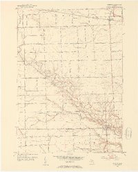
1952 Map of Memphis
USGS Topo · Published 1953About this map
Memphis sits at the junction of the St Clair Co Macomb Co line, serving as a focal point for this 1952 study of the Michigan thumb region. The town is situated along the banks of the Belle River, which winds prominently through the center of the sheet. Further north, the Grand Trunk railroad cuts through Emmett, marking a critical transportation corridor for the rural agricultural landscape.
Find a feature on this map
48 named features on this map. Tap any name to fly to it.
Don’t see what you’re looking for? This feature index may not catch every label — zoom into the map to look around manually.
Map Details
Editions of this 1952 Memphis Map
2 editions found
Other maps of this area

1914 · Armada
USGS Topo · 1:62,500

1928 · Armada
USGS Topo · 1:62,500

1928 · Hicky
USGS Topo · 1:62,500

1939 · Adair
USGS Topo · 1:24,000

1939 · Goodells
USGS Topo · 1:24,000

1944 · Memphis
USGS Topo · 1:24,000

1945 · Armada
USGS Topo · 1:24,000

1945 · Allenton
USGS Topo · 1:24,000

1945 · Richmond
USGS Topo · 1:24,000

1952 · Allenton
USGS Topo · 1:24,000