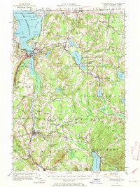
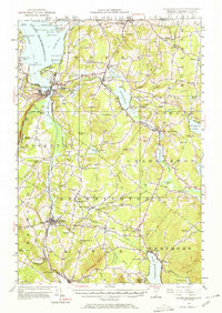
1953 Map of Memphremagog
USGS Topo · Published 1970About this map
The Canada United States international boundary bisects this landscape, separating the border towns of Beebe Plain and Derby Line from their Quebec neighbors. This mid-century revision of 1920s fieldwork reveals a region defined by its glacial lakes and a transition from industrial hubs to rural farmsteads. The Quebec Central and Canadian Pacific railroads connect the bustling lakefront of Newport and Orleans to the wider trade network, while the Willey Granite Quarry on Darling Hill points to the local extractive economy.
Find a feature on this map
102 named features on this map. Tap any name to fly to it.
Don’t see what you’re looking for? This feature index may not catch every label — zoom into the map to look around manually.
Map Details
Editions of this 1953 Memphremagog Map
5 editions found
Other maps of this area

1919 · Lake Memphremagog
USGS Topo · 1:62,500

1920 · Derby
USGS Topo · 1:62,500

1920 · Irasburg
USGS Topo · 1:62,500

1923 · Irasburg
USGS Topo · 1:48,000

1923 · Lake Memphremagog
USGS Topo · 1:48,000

1924 · Island Pond
USGS Topo · 1:48,000

1925 · Irasburg
USGS Topo · 1:62,500

1925 · Memphremagog
USGS Topo · 1:62,500

1926 · Island Pond
USGS Topo · 1:62,500

1928 · Hardwick
USGS Topo · 1:62,500