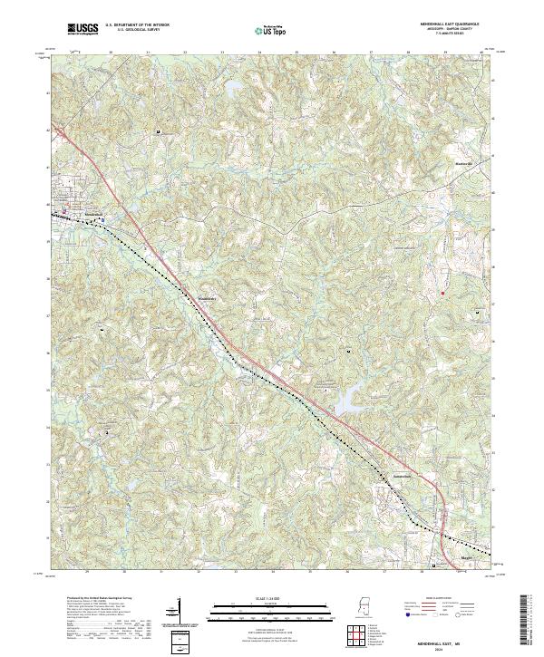
2024 Map of Mendenhall East
USGS Topo · Published 2024About this map
The Simpson County Courthouse and Simpson County Chancery Court Building anchor the municipal heart of Mendenhall in this detailed study of central Simpson County. The landscape is defined by the southeasterly flow of Okatoma Creek and Sellers Creek, where established settlements like Weathersby and Sanatorium cluster along the primary transportation corridors. The topography reveals a dense network of family-named roads and rural infrastructure, including the Copiah - Lincoln Community College Simpson County Center.
Find a feature on this map
128 named features on this map. Tap any name to fly to it.
Don’t see what you’re looking for? This feature index may not catch every label — zoom into the map to look around manually.
Map Details
Editions of this 2024 Mendenhall East Map
This is the sole edition of this map. No revisions or reprints were ever made.
Other maps of this area

1935 · White Oak
USGS Topo · 1:24,000

1953 · Hattiesburg
USGS Topo · 1:250,000

1953 · Meridian
USGS Topo · 1:250,000

1957 · Meridian
USGS Topo · 1:250,000

1958 · Hattiesburg
USGS Topo · 1:250,000

1965 · Meridian
USGS Topo · 1:250,000

1968 · White Oak
USGS Topo · 1:24,000
1968 · Puckett
USGS Topo · 1:24,000
1968 · Braxton
USGS Topo · 1:24,000

1970 · Mendenhall East
USGS Topo · 1:24,000