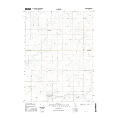
2017 Map of Mendon
USGS Topo · Published 2017About this map
Mendon sits at the southern edge of this landscape, positioned along the winding Saint Joseph River as it flows through the Michigan countryside. The terrain is defined by a complex network of waterways, where the Portage River and Little Portage Creek drain into the main river valley. This 2017 survey reveals a rural landscape characterized by organized section lines and a density of family and community burial grounds, including the Mendon Cemetery and the Saint Edward's Catholic Church Cemetery. The presence of several smaller sites like Jenkinson Cemetery and Dutton Cemetery provides specific points of interest for genealogists tracing local lineage. The drainage patterns, represented by the Portage Lake Drain and Garman Foster Drain, highlight the area's agricultural development and the managed water systems required to maintain the surrounding fields.
Find a feature on this map
76 named features on this map. Tap any name to fly to it.
Don’t see what you’re looking for? This feature index may not catch every label — zoom into the map to look around manually.
Map Details
Editions of this 2017 Mendon Map
This is the sole edition of this map. No revisions or reprints were ever made.
Other maps of this area

1914 · Three Rivers
USGS Topo · 1:62,500

1916 · Three Rivers
USGS Topo · 1:62,500

1918 · Leonidas
USGS Topo · 1:62,500

1922 · Schoolcraft
USGS Topo · 1:62,500

1943 · Three Rivers
USGS Topo · 1:62,500

1943 · Schoolcraft
USGS Topo · 1:62,500

1944 · Leonidas
USGS Topo · 1:62,500

1947 · Leonidas
USGS Topo · 1:62,500

1950 · Leonidas
USGS Topo · 1:62,500

1953 · Fort Wayne
USGS Topo · 1:250,000