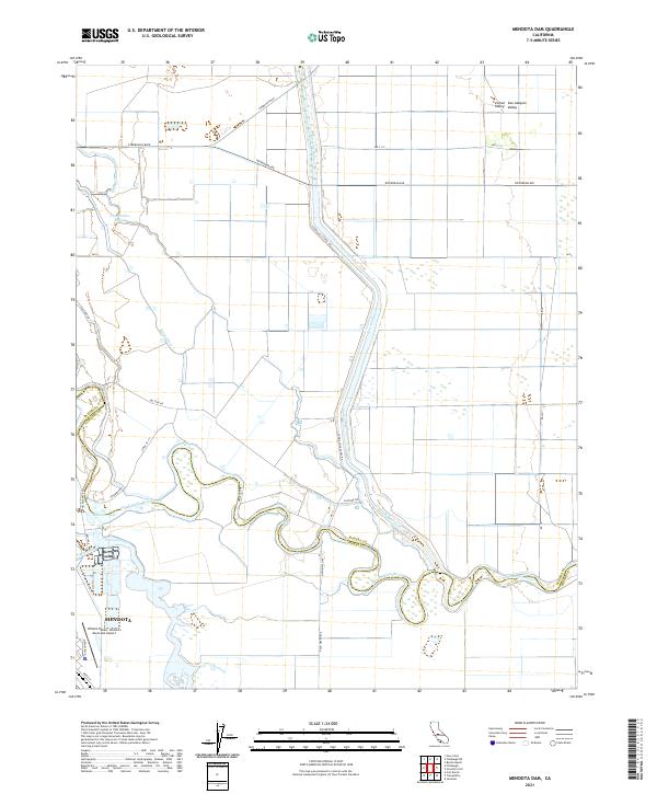
2021 Map of Mendota Dam
USGS Topo · Published 2021About this map
The San Joaquin River meanders through the heart of the Central Valley on the border of Fresno and Madera Counties. This agricultural landscape is defined by its complex irrigation and flood control network, featuring the Mendota Pool and the Eastside Bypass. The city of Mendota serves as a primary hub in the southwest corner of the map, situated near the William Robert Johnston Municipal Airport. The mapping reveals the transition from natural waterways like Lone Willow Slough and Fresno Slough to engineered infrastructure such as Chowchilla Canal Rd and Ridge Ditch. These features illustrate the managed water systems necessary for industrial-scale farming in the San Joaquin Valley during the early twenty-first century.
Find a feature on this map
31 named features on this map. Tap any name to fly to it.
Don’t see what you’re looking for? This feature index may not catch every label — zoom into the map to look around manually.
Map Details
Editions of this 2021 Mendota Dam Map
This is the sole edition of this map. No revisions or reprints were ever made.
Other maps of this area

1920 · Bonita Ranch
USGS Topo · 1:31,680

1921 · Mendota
USGS Topo · 1:31,680

1921 · Bonita Ranch
USGS Topo · 1:31,680

1922 · Tufts Ranch
USGS Topo · 1:31,680

1922 · Pozo Farm
USGS Topo · 1:31,680

1922 · Kentucky Well
USGS Topo · 1:31,680

1923 · Firebaugh
USGS Topo · 1:31,680

1924 · Jamesan
USGS Topo · 1:31,680

1924 · Tranquillity
USGS Topo · 1:31,680

1924 · Gravelly Ford
USGS Topo · 1:31,680