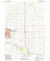
1993 Map of Mendota East
USGS Topo · Published 1993About this map
The city of Mendota serves as a primary hub on this LaSalle County sheet, showcasing its late 20th-century urban layout including the Tri-County Fairground, Blackstone Park, and institutional landmarks like Northbrook School. Beyond the city limits, the landscape transitions into the productive agricultural townships of Meriden and Ophir, where a dense network of numbered section roads, such as 44th Road, connects small settlements like Meriden and Triumph.
Find a feature on this map
51 named features on this map. Tap any name to fly to it.
Don’t see what you’re looking for? This feature index may not catch every label — zoom into the map to look around manually.
Map Details
Editions of this 1993 Mendota East Map
This is the sole edition of this map. No revisions or reprints were ever made.
Other maps of this area

1892 · Ottawa
USGS Topo · 1:62,500

1893 · Lasalle
USGS Topo · 1:62,500

1911 · La Salle
USGS Topo · 1:62,500

1913 · La Salle
USGS Topo · 1:62,500

1915 · Ottawa
USGS Topo · 1:62,500

1946 · Ottawa
USGS Topo · 1:62,500

1947 · La Salle
USGS Topo · 1:62,500

1951 · Earlville
USGS Topo · 1:62,500

1952 · Mendota
USGS Topo · 1:62,500

1958 · Aurora
USGS Topo · 1:250,000