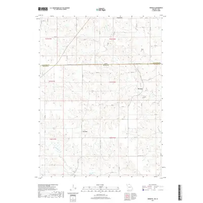
2017 Map of Mendota
USGS Topo · Published 2017About this map
Cincinnati and Mendota sit along the rolling borderlands where Appanoose County, Iowa, meets Putnam County, Missouri. This landscape is defined by the headwaters of the Chariton River basin, including North Cr, South Cr, and the winding Little Shoal Cr. The map captures a rural territory segmented by a dense grid of gravel roads and section lines, with the small settlement of Howland positioned in the southwestern portion of the quadrangle. Genealogists will find significant value in the distribution of family-named landmarks and resting places, such as Baker Cem, Boswell Cem, and Mendota Cem. The terrain is deeply dissected by drainage systems like N Blackbird Cr and Sandy Cr, reflecting the erosion patterns typical of this glacial till plain. This 2017 survey documents the modern layout of farmsteads and rural infrastructure along State Line Rd as it divides the two states.
Find a feature on this map
54 named features on this map. Tap any name to fly to it.
Don’t see what you’re looking for? This feature index may not catch every label — zoom into the map to look around manually.
Map Details
Editions of this 2017 Mendota Map
This is the sole edition of this map. No revisions or reprints were ever made.
Other maps of this area

1912 · Green City
USGS Topo · 1:62,500

1914 · Green City
USGS Topo · 1:62,500

1939 · Centerville
USGS Topo · 1:62,500

1941 · Centerville
USGS Topo · 1:62,500

1942 · Seymour
USGS Topo · 1:62,500

1944 · Seymour
USGS Topo · 1:62,500

1954 · Centerville
USGS Topo · 1:250,000

1957 · Centerville
USGS Topo · 1:250,000

1958 · Centerville
USGS Topo · 1:250,000

1964 · Unionville West
USGS Topo · 1:24,000