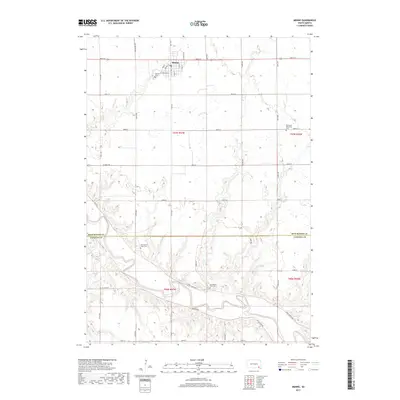
2017 Map of Menno
USGS Topo · Published 2017About this map
The town of Menno anchors this rural landscape at the edge of the Hutchinson and Yankton county lines, defined by a grid of agricultural roads and the winding course of the James River. The river cuts through the southern reaches, accompanied by the Prairie Cr drainage and numerous oxbow features that reflect the valley's complex hydrology. For genealogists and local historians, the map provides a precise record of several denominational and community landmarks, including the Menno Cem located near the town center and the outlying Ebenezer Reformed Cem to the east. Farther south, the community's heritage is marked by both Our Savior's West Cem and Our Savior's East Cem, situated near the bends of the river. The street names in town, such as Railway St, point to the historic importance of transport corridors that supported the region's farming economy.
Find a feature on this map
42 named features on this map. Tap any name to fly to it.
Don’t see what you’re looking for? This feature index may not catch every label — zoom into the map to look around manually.
Map Details
Editions of this 2017 Menno Map
This is the sole edition of this map. No revisions or reprints were ever made.
Other maps of this area

1898 · Olivet
USGS Topo · 1:125,000

1898 · Parker
USGS Topo · 1:125,000

1955 · Sioux Falls
USGS Topo · 1:250,000

1957 · Tschetter Colony
USGS Topo · 1:24,000

1957 · Midway
USGS Topo · 1:24,000

1957 · Menno
USGS Topo · 1:24,000

1957 · Wolf Creek
USGS Topo · 1:24,000

1957 · Jamesville
USGS Topo · 1:24,000

1957 · Scotland
USGS Topo · 1:24,000

1958 · Sioux Falls
USGS Topo · 1:250,000