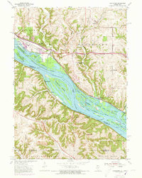
1955 Map of Menominee
USGS Topo · Published 1973About this map
The Mississippi River creates a complex landscape of backwaters and braided channels along the border of Illinois and Iowa, dominated by the expansive Upper Mississippi River Wildlife and Fish Refuge. Land use in the mid-1950s shows a transition from the river-bottom environments of Ninemile Island and Island 233 to the sharp bluffs of the Dunleith and Menominee townships. Two major rail lines, the Illinois Central and the Chicago Milwaukee St Paul and Pacific, hug the banks and traverse the wetlands near Massey.
Find a feature on this map
39 named features on this map. Tap any name to fly to it.
Don’t see what you’re looking for? This feature index may not catch every label — zoom into the map to look around manually.
Map Details
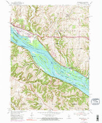
Editions of this 1955 Menominee Map
3 editions found

Other maps of this area

1900 · Lancaster
USGS Topo · 1:125,000

1901 · Peosta
USGS Topo · 1:125,000

1902 · Mineral Point
USGS Topo · 1:125,000

1904 · Lancaster
USGS Topo · 1:125,000

1908 · Lancaster
USGS Topo · 1:125,000

1911 · Galena
USGS Topo · 1:62,500

1913 · Galena
USGS Topo · 1:62,500

1935 · East Dubuque
USGS Topo · 1:62,500

1940 · East Dubuque
USGS Topo · 1:62,500

1952 · Cuba City
USGS Topo · 1:24,000