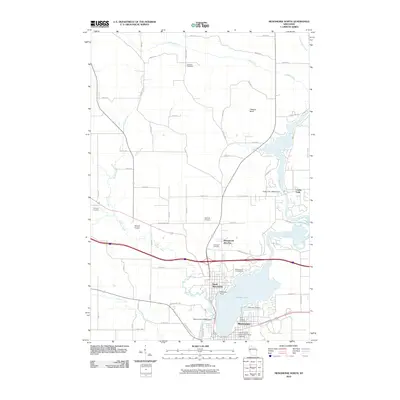
2010 Map of Menomonie North
USGS Topo · Published 2010About this map
North Menomonie and the surrounding township appear here during a period of established residential and educational growth. The landscape is anchored by the Red Cedar River as it feeds into Lake Menomin, where the Menomonie 2WP983 Dam regulates the water levels near the heart of the city. To the south, the extensive grounds of the University of Wisconsin - Stout Campus reflect the area's long-standing role as a regional center for higher learning.
Find a feature on this map
57 named features on this map. Tap any name to fly to it.
Don’t see what you’re looking for? This feature index may not catch every label — zoom into the map to look around manually.
Map Details
Editions of this 2010 Menomonie North Map
This is the sole edition of this map. No revisions or reprints were ever made.
Other maps of this area

1940 · Menomonie
USGS Topo · 1:62,500

1942 · Menomonie
USGS Topo · 1:62,500

1946 · Knapp
USGS Topo · 1:62,500

1948 · Downing
USGS Topo · 1:62,500

1949 · Knapp
USGS Topo · 1:62,500

1949 · Ridgeland
USGS Topo · 1:62,500

1950 · Downing
USGS Topo · 1:62,500

1951 · Ridgeland
USGS Topo · 1:62,500

1953 · Saint Paul
USGS Topo · 1:250,000

1953 · Eau Claire
USGS Topo · 1:250,000