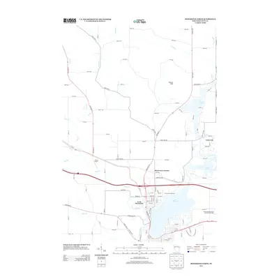
2013 Map of Menomonie North
USGS Topo · Published 2013About this map
Lake Menomin and the winding Red Cedar River anchor this topographic view of the area north of the city center. The landscape transitions from the residential and commercial blocks of North Menomonie and the transit hub at Menomonie Junction to the agricultural reaches of northern Dunn County. To the northeast, the settlement of Cedar Falls sits near the shores of Tainter Lake, while Otteson Bluff provides a notable vertical rise above the valley. Aviation history is represented by both the Skyport Airport and the larger Menomonie Municipal Airport-Score Field. Numerous tributaries, including Wilson Cr, Annis Cr, and Lambs Cr, carve through the terrain, illustrating the complex drainage patterns that have shaped the local geography and development around these interconnected water bodies.
Find a feature on this map
94 named features on this map. Tap any name to fly to it.
Don’t see what you’re looking for? This feature index may not catch every label — zoom into the map to look around manually.
Map Details
Editions of this 2013 Menomonie North Map
This is the sole edition of this map. No revisions or reprints were ever made.
Other maps of this area

1940 · Menomonie
USGS Topo · 1:62,500

1942 · Menomonie
USGS Topo · 1:62,500

1946 · Knapp
USGS Topo · 1:62,500

1948 · Downing
USGS Topo · 1:62,500

1949 · Knapp
USGS Topo · 1:62,500

1949 · Ridgeland
USGS Topo · 1:62,500

1950 · Downing
USGS Topo · 1:62,500

1951 · Ridgeland
USGS Topo · 1:62,500

1953 · Saint Paul
USGS Topo · 1:250,000

1953 · Eau Claire
USGS Topo · 1:250,000