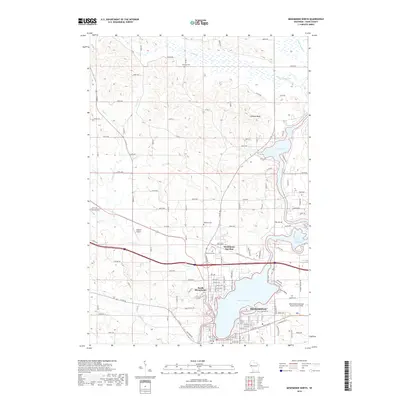
2018 Map of Menomonie North
USGS Topo · Published 2018About this map
Lake Menomin and the winding Red Cedar River dominate this 2018 survey of Dunn County, centering on the growth and infrastructure of Menomonie. The landscape is a mix of urban development and rural acreage, where the residential blocks of North Menomonie transition into the rolling terrain near Otteson Bluff. Water is the defining characteristic of the region, from the wide expanse of Tainter Lake in the northeast to the numerous drainage creeks like Coon Cr and Wilson Creek that feed into the central reservoir system. Local history is well-preserved through several dedicated sites, including Highland Cem and Sherman Cem, while the industrial and transportation legacy of the area is represented by Menomonie Junction and the Menomonie Municipal Airport-Score Field. This modern topographic study reveals how the community has organized itself around its waterways and significant landmarks like Wakanda Park.
Find a feature on this map
111 named features on this map. Tap any name to fly to it.
Don’t see what you’re looking for? This feature index may not catch every label — zoom into the map to look around manually.
Map Details
Editions of this 2018 Menomonie North Map
This is the sole edition of this map. No revisions or reprints were ever made.
Other maps of this area

1940 · Menomonie
USGS Topo · 1:62,500

1942 · Menomonie
USGS Topo · 1:62,500

1946 · Knapp
USGS Topo · 1:62,500

1948 · Downing
USGS Topo · 1:62,500

1949 · Knapp
USGS Topo · 1:62,500

1949 · Ridgeland
USGS Topo · 1:62,500

1950 · Downing
USGS Topo · 1:62,500

1951 · Ridgeland
USGS Topo · 1:62,500

1953 · Saint Paul
USGS Topo · 1:250,000

1953 · Eau Claire
USGS Topo · 1:250,000