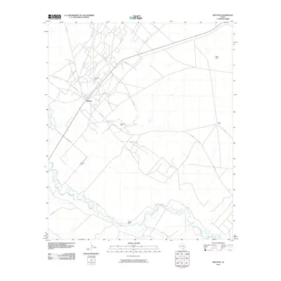
2010 Map of Mentone
USGS Topo · Published 2010About this map
Mentone serves as the focal point for this high-plains landscape, where the energy industry and cattle ranching intersect in one of the least densely populated regions of the country. The map captures the industrial footprint of the Wheat Oil Field, characterized by a dense network of local routes like Co RD 400 and Co RD 300 that weave between pumping sites. To the south, the Pecos River carves a winding path through the arid terrain, creating the distinct loop of Texas Bend. Family-named operations such as Moorehead Ranch, Goodrich Ranch, and Wheat Ranch anchor the rural landscape, highlighting the historical reliance on large-scale landholdings in this part of Texas. Natural drainages like Rudd Draw indicate the subtle topography that dictates movement across this expansive desert environment.
Find a feature on this map
19 named features on this map. Tap any name to fly to it.
Don’t see what you’re looking for? This feature index may not catch every label — zoom into the map to look around manually.
Map Details
Editions of this 2010 Mentone Map
This is the sole edition of this map. No revisions or reprints were ever made.
Other maps of this area

1954 · Pecos
USGS Topo · 1:250,000

1957 · Pecos
USGS Topo · 1:250,000

1961 · Soda Lake
USGS Topo · 1:24,000

1961 · Mentone
USGS Topo · 1:24,000

1961 · Anderson Ranch
USGS Topo · 1:24,000

1961 · Lindley Ranch
USGS Topo · 1:24,000

1961 · Sand Lake
USGS Topo · 1:24,000

1967 · Soda Lake NW
USGS Topo · 1:24,000

1968 · Mentone SW
USGS Topo · 1:24,000

1969 · Cheyenne Draw SW
USGS Topo · 1:24,000