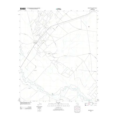
2013 Map of Mentone
USGS Topo · Published 2013About this map
Mentone serves as the focal point of this West Texas landscape, positioned near the intersection of Harris St and Collins St. The map illustrates a remote territory where the sparse settlement pattern is defined by industrial operations and traditional landholdings, such as the Wheat Oil Field and scattered homesteads including Moorehead Ranch and Goodrich Ranch. To the south, the meandering course of the Pecos River carves through the terrain, creating the distinct riverine loop known as Texas Bend. This 2013 survey provides a detailed look at the infrastructure supporting the local energy and ranching economy, from the network of county roads like Co Rd-200 to the drainage patterns of Rudd Draw in the northeast. The geography remains largely open, with long stretches of highway like Ranch Road 1216 connecting these isolated outposts.
Find a feature on this map
28 named features on this map. Tap any name to fly to it.
Don’t see what you’re looking for? This feature index may not catch every label — zoom into the map to look around manually.
Map Details
Editions of this 2013 Mentone Map
This is the sole edition of this map. No revisions or reprints were ever made.
Other maps of this area

1954 · Pecos
USGS Topo · 1:250,000

1957 · Pecos
USGS Topo · 1:250,000

1961 · Soda Lake
USGS Topo · 1:24,000

1961 · Mentone
USGS Topo · 1:24,000

1961 · Anderson Ranch
USGS Topo · 1:24,000

1961 · Lindley Ranch
USGS Topo · 1:24,000

1961 · Sand Lake
USGS Topo · 1:24,000

1967 · Soda Lake NW
USGS Topo · 1:24,000

1968 · Mentone SW
USGS Topo · 1:24,000

1969 · Cheyenne Draw SW
USGS Topo · 1:24,000