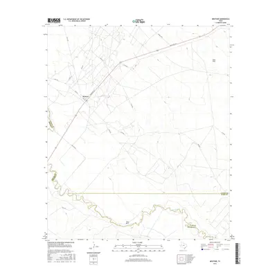
2016 Map of Mentone
USGS Topo · Published 2016About this map
Mentone serves as the focal point of this arid West Texas landscape, positioned near the intersection of Ranch Rd 1211 and several local county roads. The settlement's grid, featuring streets like Ave B and Pecos St, reflects its role as the administrative seat of one of the nation's least populous counties. The terrain is defined by the winding course of the Pecos River, which forms the southwestern boundary of Loving County. Notable hydrologic features include the prominent loop at Texas Bend and the drainage of Rudd Draw to the northeast. Transportation patterns are dictated by the oil and gas industry, indicated by the network of corridors like Lumber Co Rd and Metor Rd that branch out across the scrubland. This survey captures the sparse human footprint in a region where the vast distances between named landmarks underscore the isolation of the Permian Basin interior.
Find a feature on this map
21 named features on this map. Tap any name to fly to it.
Don’t see what you’re looking for? This feature index may not catch every label — zoom into the map to look around manually.
Map Details
Editions of this 2016 Mentone Map
This is the sole edition of this map. No revisions or reprints were ever made.
Other maps of this area

1954 · Pecos
USGS Topo · 1:250,000

1957 · Pecos
USGS Topo · 1:250,000

1961 · Soda Lake
USGS Topo · 1:24,000

1961 · Mentone
USGS Topo · 1:24,000

1961 · Anderson Ranch
USGS Topo · 1:24,000

1961 · Lindley Ranch
USGS Topo · 1:24,000

1961 · Sand Lake
USGS Topo · 1:24,000

1967 · Soda Lake NW
USGS Topo · 1:24,000

1968 · Mentone SW
USGS Topo · 1:24,000

1969 · Cheyenne Draw SW
USGS Topo · 1:24,000