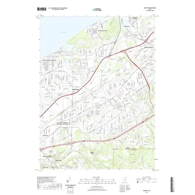
2019 Map of Mentor
USGS Topo · Published 2019About this map
The James A Garfield National Historic Site serves as a cultural anchor for this portion of Lake County, preserving the home of the 20th U.S. President. The landscape transition from the developed corridor of Mentor and Mentor-on-the-Lake to the protected natural areas like Mentor Marsh and the high ground of Little Mountain illustrates the area's diverse geography. These ecological preserves contrast with the industrial and residential centers of Painesville and Fairport Harbor, where the Grand River meets Lake Erie.
Find a feature on this map
48 named features on this map. Tap any name to fly to it.
Don’t see what you’re looking for? This feature index may not catch every label — zoom into the map to look around manually.
Map Details
Editions of this 2019 Mentor Map
This is the sole edition of this map. No revisions or reprints were ever made.
Other maps of this area

1904 · Chardon
USGS Topo · 1:62,500

1905 · Perry
USGS Topo · 1:62,500

1905 · Mentor
USGS Topo · 1:62,500

1906 · Chardon
USGS Topo · 1:62,500

1907 · Mentor
USGS Topo · 1:62,500

1950 · Cleveland
USGS Topo · 1:250,000

1953 · Chardon
USGS Topo · 1:24,000
1953 · Mayfield Heights
USGS Topo · 1:24,000

1953 · Chesterland
USGS Topo · 1:24,000

1953 · Mentor
USGS Topo · 1:24,000