
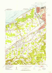
1953 Map of Mentor
USGS Topo · Published 1955About this map
Lake Erie shoreline dynamics and the industrial development of Painesville define this mid-century portrait of the Connecticut Western Reserve. The mouth of the Grand River is a focal point of activity, featuring the Old Lighthouse, the U S Coast Guard Sta, and the extensive facilities at Fairport Harbor. The landscape transitions from the maritime infrastructure of the coast to the residential and institutional growth in Mentor, where numerous schools like Mentor-Shore Sch and Mentor-Salida Sch appear alongside established landmarks like the Mentor Avenue Cem. Further inland, the terrain rises toward Little Mountain and the village of Kirtland, showing a network of rural roads and small settlements like Brentwood and Heisley before the massive expansion of the modern suburban era. The infrastructure of the Baltimore and Ohio and New York Central railroads illustrates the vital transportation corridors connecting these lakeside communities.
Find a feature on this map
55 named features on this map. Tap any name to fly to it.
Don’t see what you’re looking for? This feature index may not catch every label — zoom into the map to look around manually.
Map Details
Editions of this 1953 Mentor Map
2 editions found
Other maps of this area

1904 · Chardon
USGS Topo · 1:62,500

1905 · Perry
USGS Topo · 1:62,500

1905 · Mentor
USGS Topo · 1:62,500

1906 · Chardon
USGS Topo · 1:62,500

1907 · Mentor
USGS Topo · 1:62,500

1950 · Cleveland
USGS Topo · 1:250,000

1953 · Chardon
USGS Topo · 1:24,000
1953 · Mayfield Heights
USGS Topo · 1:24,000

1953 · Chesterland
USGS Topo · 1:24,000
1953 · Eastlake
USGS Topo · 1:24,000