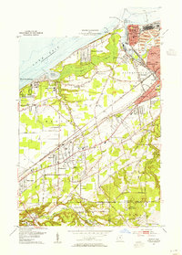
1953 Map of Mentor
USGS Topo · Published 1955About this map
Lake Erie defines the northern reaches of this coastal Ohio landscape, where the mouth of the Grand River serves as a critical industrial and maritime hub. In the early 1950s, Fairport and Painesville are established centers of commerce, showing a dense concentration of schools like McKinley Sch and institutional landmarks including Lake Erie College. The terrain transitions from the low-lying Mentor Marsh and sandy shoreline at Painesville Beach State Park to the prominent rising elevation of Little Mountain and North Ridge further inland.
Find a feature on this map
66 named features on this map. Tap any name to fly to it.
Don’t see what you’re looking for? This feature index may not catch every label — zoom into the map to look around manually.
Map Details
Editions of this 1953 Mentor Map
2 editions found
Other maps of this area

1904 · Chardon
USGS Topo · 1:62,500

1905 · Perry
USGS Topo · 1:62,500

1905 · Mentor
USGS Topo · 1:62,500

1906 · Chardon
USGS Topo · 1:62,500

1907 · Mentor
USGS Topo · 1:62,500

1950 · Cleveland
USGS Topo · 1:250,000

1953 · Chardon
USGS Topo · 1:24,000
1953 · Mayfield Heights
USGS Topo · 1:24,000

1953 · Chesterland
USGS Topo · 1:24,000

1953 · Mentor
USGS Topo · 1:24,000